DLISCES: Deep Learning, Satellite Images, Information Fusion and Applications in Disaster Risk Reduction
A multidisciplinary project to better assess socioeconomic vulnerability and improve the safety of at-risk populations and territories.
DLISCES is a multidisciplinary research project led by the LIMOS, the CERDI, CLERMA, and the LMBP, funded by the International Research Center of Disaster Science and Sustainable Development (IRC2D). The IRC2D is one of the excellence programs of the I-Site CAP 20-25 Clermont Auvergne Project and the Labex IDGM+. The four research centres are Members of the Université Clermont Auvergne, the CNRS and the IRD, the French National Research Institute for Sustainable Development.
L'équipe

Julien Ah-Pine
Université Clermont Auvergne, LIMOS, CERDI
Michaël Goujon
Université Clermont Auvergne, CERDI

Selim Mankaï
Université Clermont Auvergne, CLERMA
Pascale Phélinas
IRD, CERDI

Olivier Santoni
CERDI, Labex IDGM+

Andrzej Stos
Université Clermont Auvergne, LMBP
Context and objectives of the project
Exploratory research will be used to produce maps of diverse indicators to evaluate the vulnerability of the population and territories exposed to climatic risk. To reach this objective, researchers in AI, management, and economics will work together in an innovative way and leverage complex and heterogeneous data with machine learning and deep learning models.
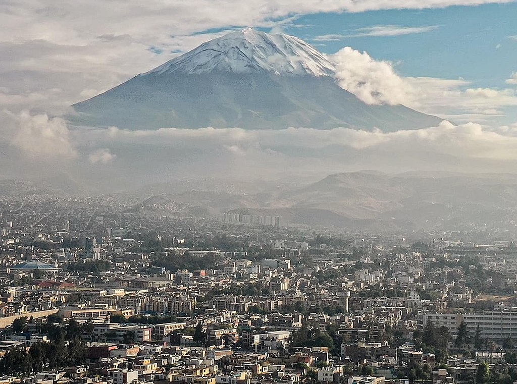
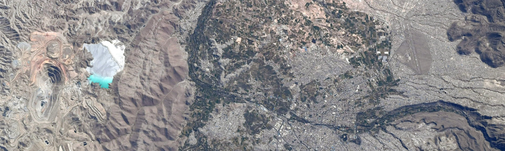
Photo : Cristian123gme, CC BY-SA 4.0 via Wikimedia Commons
First, they will study Arequipa, a city in Peru regularly exposed to natural disasters. The Misti volcano is still active and causes dramatic mudslides and lahars. The latest eruption impacted approximately 12,000 people, 15 of whom died and more than twenty were injured. The UCA's teams have a deep knowledge of this terrain and have conducted several studies on the interactions between societies and natural disasters.
In this context, to reduce risk, there is an urgent need for a better estimation of the vulnerability of the population and infrastructures to the various climatic events. Indeed, the cartography of the vulnerability indicators is limited and mostly based on expensive surveys. The DLISCES project will exploit open data (satellite images, surveys, topographical data, weather data, etc.) with the help of AI and information fusion methods to create comprehensive maps of indicators.
These data science tools will also be applied within the context of actuarial science. Currently, a minority of people subscribe to insurance while index-based insurance can cover such climate events andcontribute to reduce the risk of disaster. This type of insurance allocates an indemnity determined by an index correlated with the losses. However, the relationship between the trigger threshold and the real losses is not always accurate and, the compensation may not fully cover the losses. AI can help address these issues as well.
The team will also develop and strengthen collaborations with local researchers and build partnerships with European and international consortiums.
Methodology
This project promotes a multidisciplinary approach that includes data science, economics, insurance science, risk management and geomatics.
The team will explore several types of massive data, including satellite images, household surveys, and meteorological and topographical data.
The team will also analyze and cross these complex and heterogeneous data using advanced techniques of machine and deep learning.
Expected results
A prototype will be developed to create maps of unitary and composite indicators that will reflect the diverse dimensions of vulnerability in Arequipa. Another prototype will conduct the inference of robust cartography of reference indices and trigger thresholds for the index-based insurance.
The results of this study will contribute to defining risk mitigation policies. The team will consider applying this methodology to other case studies.
The partners